Cooler and Drier Weather Coming to Corn Belt?
Wednesday, July 3, 2024 • 1 PM
We have seen some ups and downs, but most of the country, especially the Corn Belt, has seen above-normal temperatures for the last few months. In some cases, it has been extremely hot like mid-June in the Eastern Corn Belt, and recently in the Southern Plains and Gulf Coast. In other cases, it has been just a few degrees above normal more consistently than not. However, analyses from DTN and the Iowa Environmental Mesonet show almost all areas east of the Rockies have had above-normal temperatures since the first of April. Only the northern High Plains areas in Montana and Wyoming along with the Black Hills in South Dakota have had temperatures below normal. To go along with that, most areas have also had above-normal precipitation. Those in the Mid-Atlantic and parts of the Southeast and Central and Southern Plains have not been as lucky, but the vast majority of the Corn Belt has seen above-normal precipitation. Of course, some areas have had too much rain, which has caused flooding, and others have had too little rainfall, causing flash drought. Precipitation has ebbed and flowed over the last three months, as it typically does. But it certainly has been an active period of weather, and some areas could really use a break from the rainfall.
You can find more from the Iowa Environmental Mesonet and create your own plots of their data here: https://mesonet.agron.iastate.edu/…
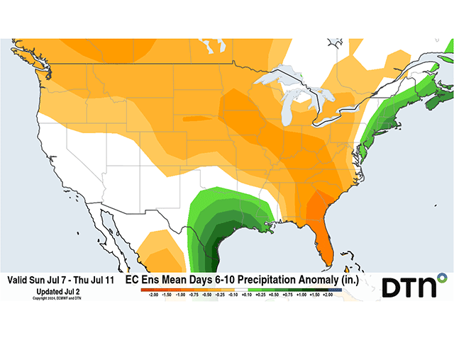
We continue to have a very busy pattern across the U.S. over the next week. System after system will move through Canada or the northern U.S. and send cold fronts through the Corn Belt. We have already seen some areas of heavy rain in southeastern Nebraska on July 1, and we are poised to see more from this system the rest of the week. Temperatures across the South and Gulf Coast will continue to be hot and challenge the 100-degree threshold. But we are going to see a change in the pattern for next week.
In the upper levels of the atmosphere, we have a ridge of high pressure across the South and Southeast. That is creating the intense heat this week. A trough of low pressure is currently found across the Canadian Prairies and Northern Plains on July 2. The ridge will keep that trough northward the next few days, and another trough will move in right behind it to end the week, creating more rain for the Corn Belt.
But we will be watching a trough in the North Pacific and another coming down from northern Canada this weekend. A piece of energy will escape the Pacific trough and get pushed southward by the Canadian trough, splitting the ridge and forcing the majority of it into the Western U.S. where temperatures are forecast to spike into British Columbia going into next week. At the same time, a more consistent troughing feature will be spread out across the Central U.S. while the second part of the ridge will remain off the East Coast.